Urban Flooding: The Science Behind RVA's 9/16 Deluge
Yesterday we saw some pretty extreme weather in Richmond. Since there’s been a bunch of discussion on social media and in the news about the causes, we’re bringing in our climate scientist to try to elevate the discourse about urban flooding in our area—with science!

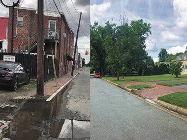
So, what happened? On September 16, 2021, a community science CoCoRaHS station located in Scott’s Addition logged an impressive 3.4 inches of rain in under an hour! Several other locations near the Science Museum accumulated similar amounts of rain, and this resulted in substantial and damaging flooding throughout the city.
It’s important to note here that individual floods at individual road intersections in the City of Richmond (and anywhere else, for that matter!) are the momentary expression of a complex system of interconnected pieces including stormwater management, infrastructural design, rainfall amount, and land use. As such, the solutions to these issues are multifaceted and are more like silver buckshot (lots of simultaneous, targeted efforts at once) than a silver bullet (one fix-all solution).
OK, now let’s talk science!
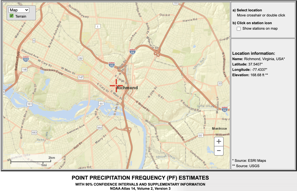
First, stormwater management systems in Richmond (and just about everywhere else) are designed to accommodate a specific standard amount of precipitation set by the NOAA Atlas 14. This application provides estimates of the intensity, duration, and frequency (IDF) of rainfall events for a given geography.
There's an interactive web platform you can use to find Richmond's IDF estimates here: https://hdsc.nws.noaa.gov/hdsc/pfds/pfds_map_cont.html. Type "Richmond, VA" into the "By Address" bar at the top. You should see this map:
Scroll down below the map and you'll see this chart, which shows rainfall:
- duration (with longer-lasting events further down)
- amount (from left to right on the chart, heavier rainfall events to the right)
- average recurrence intervals along the top (or how rare a particular rainfall event is based on historical data)
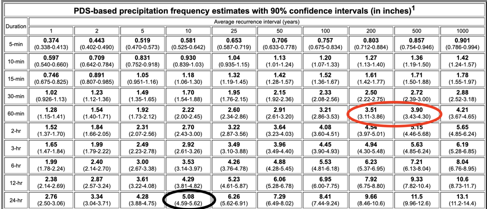
The black circled 5.08" is the 10-year, 24-hour precipitation amount that our stormwater systems are currently designed to accommodate. The red circle shows what fell yesterday near the Science Museum (~3.4 inches in ~60 minutes). This chart explains that the rain we experienced yesterday was somewhere between the 100- and 500-year event (within the range of values) for the given duration of rainfall—a particularly rare storm! This amount of rain in such a short duration of time far exceeds the design capacity of our stormwater system, which leads to flooding.
Many people have suggested that clogged storm drains may have exacerbated the flooding in some places, which is definitely possible. But, this chart shows that even if all of the drains in the city were completely clean as a whistle, we would have still experienced flooding in many places because it was just too much rain!
Takeaway: extreme rainfall is hard to accommodate with Richmond’s current infrastructure, even without clogged drains.
The City of Richmond’s RVAH2O program has an online social media presence and talks about the magnitude of investments that are required (and being made!) to bring our aging stormwater infrastructure into the 21st century. Check out this StoryMap they created about Richmond’s Combined Sewer System.
Second, let’s look at how climate change fits into this. A warmer atmosphere holds more water vapor in it. This translates to about 5-7% more water vapor per 1.8°F (1°C) warming. This change in our atmosphere’s water vapor carrying capacity basically means that a climate-changed atmosphere can produce more intense amounts of precipitation over shorter durations of time. In fact, we’ve seen this change in very heavy precipitation amounts occurring already across the country, as identified in this graphic from the National Climate Assessment:
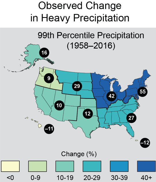
This increase in frequency of extreme precipitation events threatens our stormwater system now, as well as into the future with more warming.
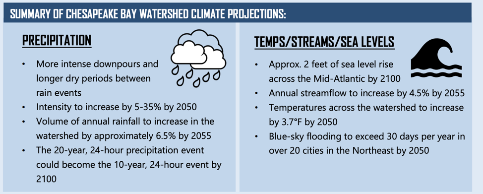
Intense precipitation events like yesterday's are expected to become even more intense, and by as much as 35% in the Chesapeake Bay watershed! This amount of warming and accompanying precipitation intensification is entirely dependent on how much more heat-trapping carbon dioxide gas we collectively emit from burning fossil fuels. Learn more about the potential climate futures and threats to stormwater infrastructure from the Chesapeake Stormwater Network's Fact Sheet on Stormwater and Climate Change.
Takeaway: "More intense downpours … intensity to increase [due to warming]."
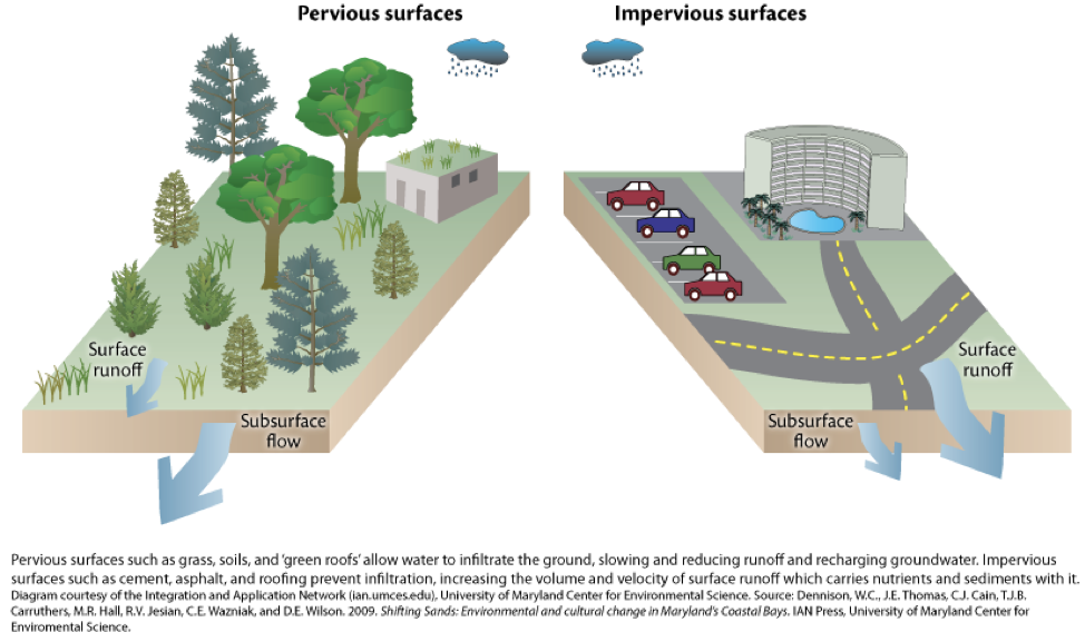
But, there’s something else going on in the background as well: land use changes. This means paving over natural landscapes and rural areas surrounding the city to accommodate more sprawling development, which contributes to the flooding. Hard, impervious surfaces like asphalt roads and parking lots funnel stormwater into the sewers instead of filtering it like more natural landscapes. Even without climate change making heavy rainfall events heavier and more frequent, increasing impervious surfaces in and around our city increases our risk of flooding.
Here’s a visual from the University of Maryland Center for Environmental Science:
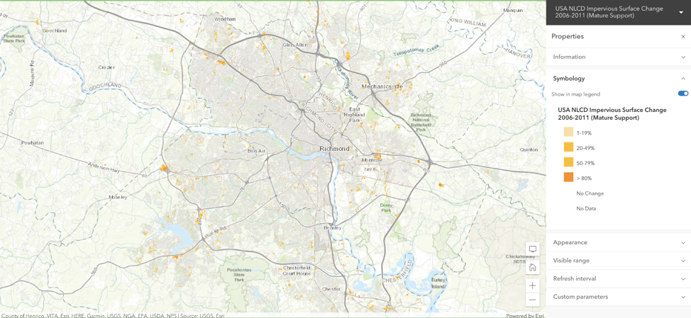
We know that most of the land use change from natural landscape into impervious surfaces has occurred on the urban periphery in the counties surrounding Richmond since 1950. This pattern of development very likely contributes to flooding vulnerability in the city, which this ArcGIS map shows in places that increased in imperviousness between 2006 and 2011:
While this data paints a somewhat gloomy picture, there are exciting parts to be hopeful about in the near future. The Science Museum is leading the way on solutions to these issues through building The Green, a multi-acre civic greenspace right in front of the building along Broad Street!
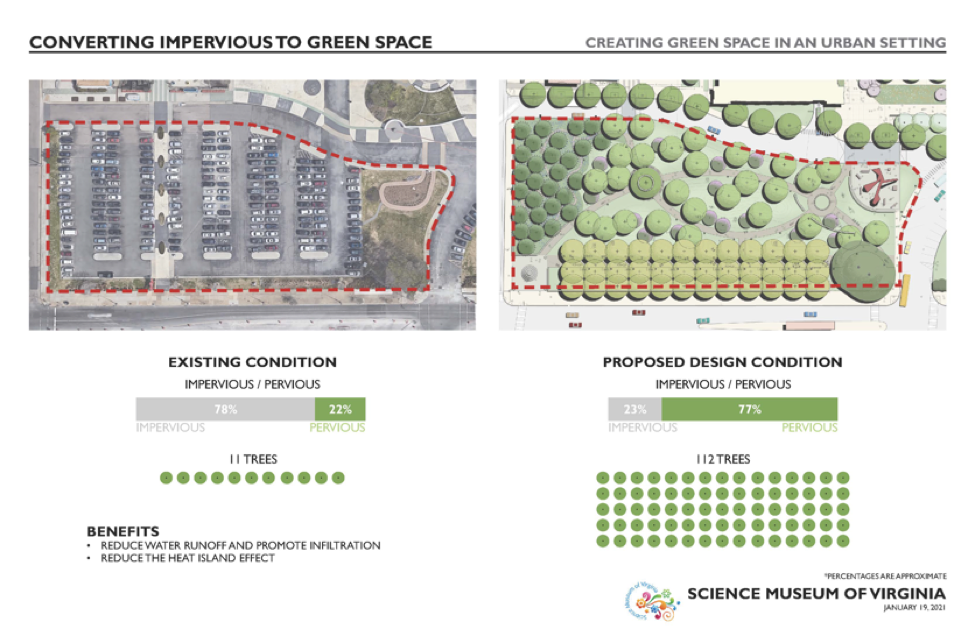
While The Green won't fix everything—remember: environmental issues require silver buckshot, there are no silver bullets—it will help the Science Museum reduce our contribution to the city's stormwater system considerably. The Green will be the Museum’s public learning laboratory to show just how these sorts of land use transformations can help reduce impacts on the environment, like flooding, while also reducing temperatures and cleaning our air.
Ultimately, floods are (again) very complex, especially in urban areas. They’re the ultimate expression of many systems working interconnectedly all around us. Science can help us understand how these systems function independently, and arm us with the information necessary to make informed decisions with resources to address the issues at hand.
