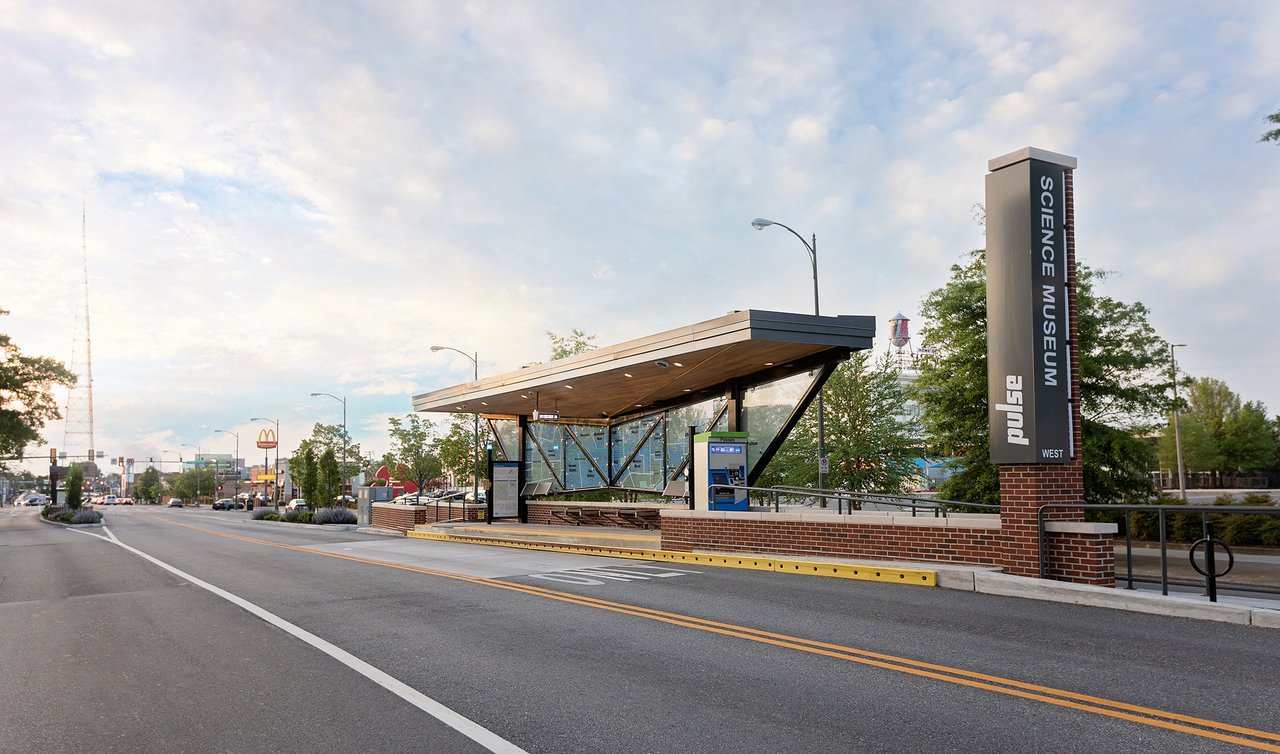
“Parking to Park...” is a unique partnership between GRTC and the Science Museum of Virginia created with the intention of bringing awareness around the need for greater transit access to greenspace for all members of our region as well as balancing the regional needs of parking, parks and resiliency.
How Are Land-Use Decisions and Climate Change Related?
According to the Richmond 300: A Guide For Growth Insights Report, more land surface in Richmond is paved over than currently used for public park spaces.
Meanwhile, years of sprawling suburban development and lack of safe, connected multi-use pathways has made it seemingly necessary for families to use cars to get into and around the city. In addition, urban planning decisions have overburdened inner-city neighborhoods with fewer trees, proximity to traffic and outdated stormwater infrastructure.
As climate change continues to make extreme heat and rainfall events more common and more intense, land-use decisions can magnify those events, particularly in neighborhoods with fewer green spaces. The blogs below provide more information about how land use and climate change are related and what impacts our city is feeling today.
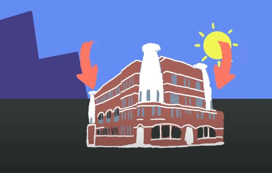
The Science Museum received a grant from the Virginia Academy of Science to work with multiple partners to measure the city’s temperature in various places all at once during a heat wave. The goal was to identify the strength of Richmond’s “urban heat island effect.”
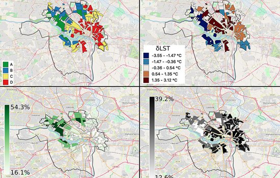
A Science Museum study linked higher land surface temperatures to formerly redlined areas in 108 US cities. Redlined areas have fewer trees than their non-redlined neighbors, allowing more of the Sun’s energy to get soaked up and amplified by human-built surfaces.
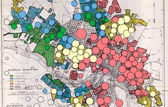
Two papers published by the University of Richmond in collaboration with the Science Museum explore the relationships between temperature, air quality, socio-demographic factors and historical planning decisions for the City of Richmond.
How Can We Become More Resilient?
Parks and green spaces—through tree canopy shade, rainfall-absorbent surfaces and air-cleaning vegetation—are an asset to the city’s climate resilience goals, as they provide some of the most natural landscapes that remain within the city’s bounds.
At the individual level, there are many options for families to help build community resilience to climate change in their own backyard. Installing rain barrels and planting native trees and shrubs to replace your lawn are two ways to start treating your yard like a climate action laboratory.
For renters and those without the financial means to improve their landscaping, there are opportunities to volunteer with one of the many local organizations working to expand and improve green spaces in the Richmond community. Check out the HandsOn Greater Richmond volunteer portal or keep up with the events calendar on Southside ReLeaf's website to find an event near you.
Finally, we can all look for ways to limit and reduce the amount of driving we do as a way to limit heat-trapping gas emissions that are the root cause of climate change. We can do this through supporting compact and dense housing throughout the city and expanding the reliability, frequency, and connectivity of public transportation options like GRTC.
On the Science Museum's campus, we have begun construction on Phase 1 of a project that will reclaim two acres of asphalt surface parking and reestablish the front acreage of historic Broad Street Station as a new 6-acre public green space. The project aligns with the city’s Richmond 300 development plan, which prioritizes green infrastructure for Greater Scott’s Addition, one of the fastest growing, mixed-use neighborhoods in the city with one of the lowest levels of urban tree cover.
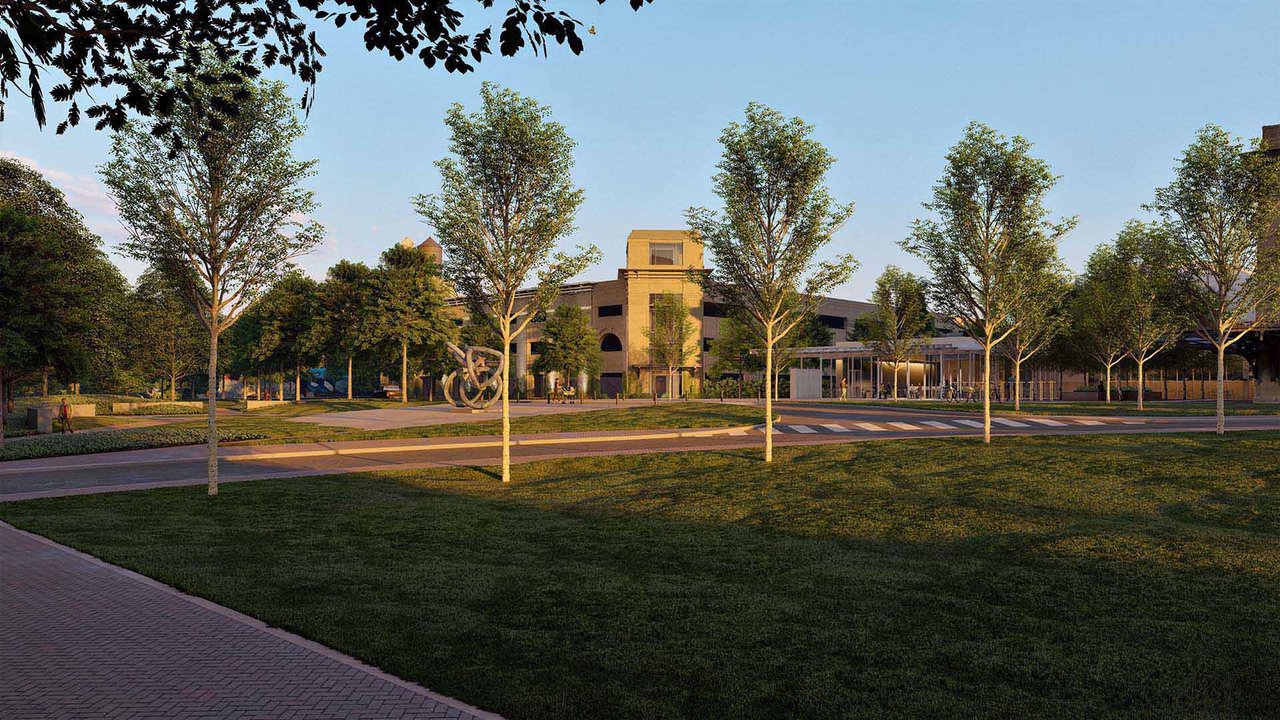
The Green will serve as both a welcoming park and a living classroom that will implement natural solutions to address the impacts of climate change in an urban setting.
The Vision for The Green
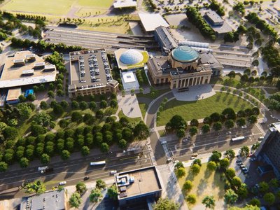
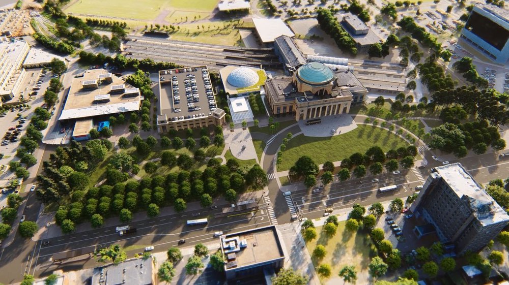
The Green will be accessible by public transportation, sitting directly on the Pulse BRT line that travels Broad Street. Until The Green is complete, you can visit other park space using public transportation within the city. Take a look at the options below provided by GRTC.
Richmond Region Parks Accessible By GRTC
Pulse, 1, 1A, 1B, 1C, 2A, 2B, 2C, 3A, 3B, 3C, 5, 12, 14, 50, 77, 78, 87Bandy Field Nature Park
79Battery Park
1, 1A, 1B, 1C, 2A, 2B, 2C, 20Briel Street Park
13Broad Rock Sports Complex
1B, 1C, 86Brown's Island Park
1, 1A, 1B, 1C, 2A, 2B, 2C, 3A, 3B, 3C, 5, 14, 87Byrd Park
5, 20, 77, 78 Cannon Creek Nature Area
2A, 2B, 2C, 3A, 3B, 3C, 20 Canoe Run Park
2A, 2B, 2C, 3A, 3B, 3C, 87Chelsea Village Park
5Chimborazo Park
12, 13, 56Covington Road Properties (Sankofa Community Orchard)
1ADavee Garden Fitness & Walking Trail
3B, 3C, 88Dove St Recreation Area
2A, 2B, 2C, 3A, 3B, 3CEthel Bailey Furman Park
7A, 7B, 12, 13, 56Federal Park
5, 20, 77, 78Fonticello Playground (Carter Jones Park)
1, 1A, 1B, 1C, 2A, 2B, 2CForest Hill Park
2A, 2BGabriel's Freedom Park
3A, 3B, 3C, 20Gillies Creek Nature Area (Fulton Park)
Pulse, 4A, 4B, 56Grace Park
Pulse, 14, 50, 76Henderson Sports Complex
1, 1A, 1B, 1C, 93Hioaks Water Tower
2BHorace Edwards Playground (Clark Springs School)
5, 77, 78 James River - Belle Island
2A, 2B, 2C, 3A, 3B, 3C, 87James River - Great Shiplock Park
Pulse, 4A, 4B, 12, 13, 14James River - North Bank Park (Texas Beach)
78Jefferson Park
4A, 4B, 5, 7A, 7B, 12, 13, 14, 56Kanawha Plaza Park
Pulse, 1, 1A, 1B, 1C, 2A, 2B, 2C, 5, 7A, 7B, 12, 14Libby Hill Park
Pulse, 4A, 4B, 7A, 7B, 12, 13, 14, 56Little John Park
14Maymont House & Park
78Monroe Park
Pulse, 3A, 3B, 3C, 5, 14, 50, 77, 78, 87Mosby Court Community Center/Parker Field
5, 12Oregon Hill Linear Park (Samuel Parsons)
3A, 3B, 3C, 87Paradise Park
5, 77, 78Patrick Henry Park
Pulse, 4A, 4B, 7A, 7B, 12, 13, 14, 56Petronius S Jones Park
5, 77, 78Pine Camp Park and Arts Center
1, 1A, 1B, 1C, 93Pollard Park
1, 1A, 1B, 1C, 20Powhatan's Hill Park
4BProvidence Park Playground
2A, 2B, 2C, 3A, 3B, 3C, 91Redd Elementary Field
2BRMA Deck Park
2A, 2B, 2C, 5, 14 Robert Pleasants Park
3A, 3B, 3C, 5, 77, 78, 87Roy West Park (Washington Park)
1A, 1B, 1C, 2A, 2B, 2C, 93Scuffletown Park
Pulse, 5, 20, 50, 76, 77, 78Summer Hill Softball Diamond
3B, 3C, 88Taylor's Hill Park
Pulse, 4A, 4B, 7A, 7B, 12, 13, 14, 56Third Avenue Tot Lot
3A, 3B, 3CThomas Jefferson Tot Lot
50, 76, 91Thomas Square
5, 77, 78Southside Flood Wall
1, 1A, 1B, 1CWythe High School Track
2C, 20Cheswick Park
79Dabbs House Museum/Glen Echo Recreation Area
7A, 7BHenrico Theatre
7A, 7BHighland Springs Community Center & Recreation Area
7A, 7BSandston Recreation Area
7A, 7BShort Pump Park
19Falling Creek Ironworks Park
3BWestwood Park
76, 79
5, 20, 78Bojangles Triangle Park (Bill Robinson Square)
Pulse, 1, 1A, 1B, 1C, 2A, 2B, 2C, 3A, 3B, 3C, 12, 50, 78, 87Reconciliation Triangle Statue
Pulse, 1, 1A, 1B, 1C, 2A, 2B, 2C, 5, 7A, 7B, 14, 56St John's Church and Cemetery
Pulse, 4A, 4B, 7A, 7B, 12, 13, 14, 56Dabbs House Museum/Glen Echo Recreation Area
7A, 7B
5, 14, 50, 77Carrington Street Triangle
5, 7A, 7B, 12Conrad Street Mini-Park
5Lt Charles Bland, Sr Park (Triangle Park)
1, 1A, 1B, 1C, 2A, 2B, 2C, 20Meadow Street Triangle Park (Custshaw Place)
Pulse, 5, 50, 76, 77, 78Sydney Park
5, 77, 78Yancey Street Playground
2A, 2B, 2C
Pulse, 1, 1A, 1B, 1C, 2A, 2B, 2C, 3A, 3B, 3C, 5, 12, 14, 50, 77, 78, 87Alice Fitz Playground
1, 1A, 1B, 1C, 2A, 2B, 2C, 3A, 3B, 3C, 87Ashbury Triangle Park (Lombardy Triangle)
5, 14, 50, 77Battery Park
1, 1A, 1B, 1C, 2A, 2B, 2C, 20Bill Robinson Park
12, 13, 56Broad Rock Community Center and Playground (School)
86Broad Rock Sports Complex
1B, 1C, 86Calhoun Community Center and Playground
1, 1A, 1B, 1C, 2A, 2B, 2CChimborazo Playground
Pulse, 12, 13, 14, 4A, 4B, 56Fonticello Playground (Carter Jones Park)
1, 1A, 1B, 1C, 2A, 2B, 2CGillies Creek Nature Area (Fulton Park)
Pulse, 4A, 4B, 56Grayland Playground
5, 20, 77, 78Henderson Sports Complex
1, 1A, 1B, 1C, 93Highland Park Plaza Community Center (Anne Hardy Plaza)
3A, 3B, 3CHolly Street Playground
3A, 3B, 3C, 87Horace Edwards Playground (Clark Springs School)
5, 77, 78Jefferson Park
4A, 4B, 5, 7A, 7B, 12, 13, 14, 56Mary M Scott Playground
2A, 2B, 2C, 91Mary Munford Playground
77Mashore Playground (Old Pilkington Playground)
1, 1A, 1B, 1CMaymont Playground
78Montrose Heights Playground
4ANorrell Elementary School Annex
2A, 2B, 2COak Grove Playground
3A, 3B, 3C, 87Oakwood Park Playground
12, 13Pine Camp Park and Arts Center
1, 1A, 1B, 1C, 93Providence Park Playground
2A, 2B, 2C, 3A, 3B, 3C, 91Randolph Community Center
5, 77, 78Smith-Peters Playground
Pulse, 14, 50, 77, 78Swansboro Playground
1, 1A, 1B, 1C, 2CThird Avenue Tot Lot
3A, 3B, 3CThomas B. Smith Community Center/Ruffin Road Playground
3B, 3C, 88Thomas Jefferson Tot Lot
50, 76, 91Westwood Playground
76, 79Whitcomb Court Community Center & Playground
5Yancey Street Playground
2A, 2B, 2C
3A, 3B, 3C, 87Blackwell Community Center (Charlie D Sydnor Playground)
1, 1A, 1B, 1C, 3A, 3B, 3C, 87Broad Rock Community Center and Playground (School)
86Calhoun Community Center and Playground
1, 1A, 1B, 1C, 2A, 2B, 2CHickory Hill Community Center
88Hotchkiss Community Center
20, 2A, 2B, 2C, 3A, 3B, 3CHumphrey Calder Community Center
5, 76, 77, 78Mosby Court Community Center/Parker Field
5, 12Powhatan's Hill Community Center
4BRandolph Community Center
5, 77, 78Southside Community Center
1BThomas B. Smith Community Center/Ruffin Road Playground
3B, 3C, 88Thompson Community Center
2AWestover Community Center
2A, 2B, 20Whitcomb Court Community Center & Playground
5Highland Springs Community Center & Recreation Area
7A, 7BStone Bridge Recreation Center
1A, 2B
Hungry For More?
Connect to the most cutting-edge understanding of how cities are using green spaces like parks to advance climate justice and resilience using these links:
Learn More About The Green
Learn More About Public Transportation in Richmond
